
Oxnard ZIP Codes Across the Delivery Grid
USPS routing groups 93030 through 93032 under OXNARD CA 93030, 93033 through 93034 under OXNARD CA 93033, and 93035 through 93036 under OXNARD CA 93035. That grouping is a mail-routing convention. It does not turn every code into a residential district or establish an incorporated boundary. Standard street-delivery codes are 93030, 93033, 93035, and 93036. The other rows are PO-box codes. The area descriptions below are practical geography drawn from official city maps and postal facility information, not a legal ZIP boundary map.
| ZIP | Areas Covered | Post Office | Notes |
|---|---|---|---|
| 93030 | Central and north-central Oxnard; Downtown, La Colonia, Wilson, and parts of Fremont, Cabrillo, Carriage Square, and West Village | Federal Building Oxnard, 350 S A St, Oxnard CA 93030-5899 | Street delivery; reaches the El Rio and unincorporated edge |
| 93031 | PO boxes | 93030 postal grouping | PO-box code, not a residential district |
| 93032 | Downtown PO boxes | Federal Building and downtown context | PO-box code; a box does not locate a premises |
| 93033 | South and east Oxnard; Lemonwood/Eastmont, College areas, Southwinds, Pleasant Valley, and portions toward Ormond and Port Hueneme | Saviers, 2520 Saviers Rd, Oxnard CA 93033-9998 | Street delivery; city and Port Hueneme edges need a jurisdiction check |
| 93034 | PO boxes | 93033 and Saviers grouping | PO-box code, not a residential district |
| 93035 | West and coastal Oxnard; Channel Islands, Marina West, Via Marina, Oxnard Shores, Oxnard Dunes, and nearby coastal neighborhoods | Oxnard postal network | Street delivery; harbor, coastal, and municipal lines differ |
| 93036 | North and northeast Oxnard; RiverPark, Town Center/Collection, Rio Lindo, River Ridge, Windsor North River Ridge, and Orchard Park | John R. Hatcher III Post Office and Oxnard S&DC, 1961 N C St, 93036-9996/9997 | Street delivery; RiverPark growth and El Rio proximity make the caveat important |
The table separates street-delivery codes from mailbox codes. 93030, 93033, 93035, and 93036 each need a different map check. A postal label can sit near another jurisdiction, so it is a first sort, not the last word on location.
The USPS Postal Bulletin routing table supplies the grouped labels used for the Oxnard ZIP rows.
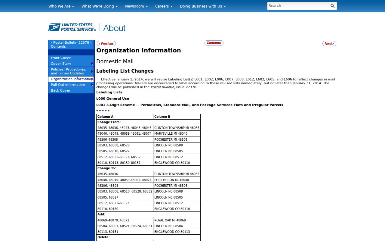
That routing view sorts delivery operations; city, parcel, and neighborhood sources still have to be checked separately.
Oxnard PO-Box ZIP Codes Explained
93031, 93032, and 93034 are PO-box codes, not residential districts. They identify mailbox service inside the USPS grouping, not a set of homes that can be outlined on a parcel map. A family letter, business card, or older directory entry may show one of these codes because the sender used a box. That clue can help place the mail channel, but it cannot place the sender's house or prove that the named person lived in Oxnard.
93031 sits in the 93030 postal grouping. 93032 is associated with downtown PO boxes, while 93034 follows the 93033 and Saviers grouping. None should be used to draw a resident polygon. For a genealogy or reconnecting question, pair the name and date with a street address, a directory entry, a newspaper item, or a custodian-held record. If the only location clue is a PO box, preserve that limit in the research notes.
Mailbox code, not residence proof. A PO-box ZIP locates a delivery arrangement. It does not show where a person sleeps, owns land, or receives services.
Oxnard ZIP 93030 and the Central Grid
93030 is the practical postal starting point for Oxnard's central and north-central grid. City history describes the late-1890s townsite as running from Wooley Road north to Magnolia Boulevard and from Saviers Road west to F Street. The original pattern used alphabetical north-south streets and numbered east-west streets, with 80-foot north-south streets. Five Points is where Oxnard Boulevard, Saviers Road, and Wooley Road converge. The City of Oxnard department history preserves that local grid context.
Downtown, La Colonia, Wilson, and parts of Fremont, Cabrillo, Carriage Square, and West Village orient the 93030 core. They are not substitutes for a full-address USPS result or jurisdiction layer. Old family notes may keep a street name while a later record keeps only the postal code. Compare both before treating entries as different places.
Oxnard ZIP Geography in 93033
93033 serves the south and east side of Oxnard. The practical area description includes Lemonwood/Eastmont, College areas, Southwinds, Pleasant Valley, and portions toward Ormond and the Port Hueneme edge. That is a useful way to sort a search, but the postal code does not settle whether a specific parcel is incorporated Oxnard, near Port Hueneme, or in an unincorporated pocket. The address itself must be checked against the local jurisdiction map.
For a family-history search, retain the street, house number, year, and any old place label along with 93033. A ZIP change or a broad mailing city can make a record look like a move when the underlying street is near a boundary. The best comparison is a dated address against USPS delivery data and the City's interactive map, followed by parcel research if ownership or land history matters.
Coastal Oxnard ZIP Code 93035
93035 is the west and coastal street-delivery code. Its practical geography includes Channel Islands, Marina West, Via Marina, Oxnard Shores, Oxnard Dunes, and nearby coastal neighborhoods. Coastal streets can sit close to harbor facilities, municipal edges, and other lines that do not follow the postal service's routing design. The code therefore works well for narrowing a mail address, but it does not define a neighborhood or guarantee that every nearby parcel shares the same government custodian.
When an old postcard, directory, or estate paper gives 93035, confirm the full street address before tracing a person or parcel. A marina label can be more specific than the mailing city, while the ZIP remains broad. Compare the postal result with the city map and parcel identifiers.
Oxnard ZIP Code 93036 and RiverPark
93036 covers the north and northeast growth area. RiverPark, Town Center and Collection, Rio Lindo, River Ridge, Windsor North River Ridge, and Orchard Park are the key local reference points in the research. El Rio is close enough to make the postal-versus-city distinction important, especially when an address is being routed to the right planning, permit, or property source.
The USPS Oxnard facility listing identifies the local postal network and the John R. Hatcher III Post Office/Oxnard Sorting and Delivery Center at 1961 N C Street. Facility service is an operations clue, not a city-boundary list.
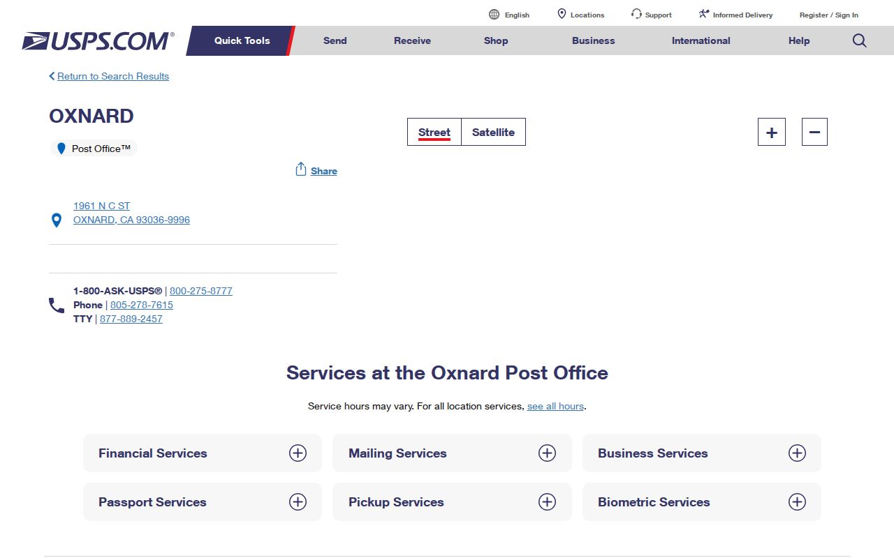
It shows local network context, not a resident count or a postal boundary for RiverPark, El Rio, or another named area.
Finding Oxnard Residents by ZIP Code
A ZIP-keyed search should begin with an address, not with an assumption that an open list of all residents exists. Ventura County's property tools are parcel and address tools. California's voter system lets a person check their own registration, while a voter-file extract requires a qualifying application and does not create an unrestricted neighborhood roster. Postal verification keeps the rest of the search tied to a real delivery point.
- Enter the complete street address in the official USPS address-to-ZIP lookup and save the returned ZIP or ZIP+4 result.
- Open the City's maps to compare the mailing address with incorporated jurisdiction, named neighborhood, street, and planning layers.
- Use the interactive zoning and address map to read Jurisdiction, Neighborhood, Zoning, General Plan, and Numbers for the same address.
- If parcel context matters, obtain the APN through the county address search, then inspect the Assessor and County View records by APN or situs address.
Once a postal check narrows the question to a street, the Oxnard street directory can take over the street-level address workflow. Keep the distinction clear: an assessor result may identify an assessee or parcel, and a voter result may reflect an authorized registration record, but neither is a complete household list. A name, role, date, and address still need to agree before a person is treated as the same individual.
Oxnard ZIP Verification with USPS and APN
The official USPS form answers one narrow question: where should a complete address be routed? Use the fields in sequence, then carry the result into city and county records. The returned ZIP can include a ZIP+4 refinement, but it remains postal information rather than a parcel, voter, or residence record.
| Street address | Enter the full delivery address, including the house number and street name. |
|---|---|
| City | Use the mailing city shown for the address; OXNARD is delivery geography, not incorporation proof. |
| State | Select California or CA so the lookup stays within the correct state routing system. |
| Lookup result | Read the five-digit ZIP and any ZIP+4 returned for that address, then save the result with the date checked. |
The USPS address-to-ZIP lookup is the correct first stop when a street record has a disputed or incomplete postal code.
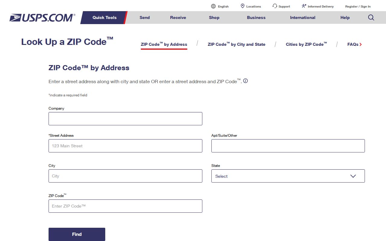
The lookup image shows the postal task in its proper lane: verify delivery first, then use the city and county tools for jurisdiction and parcel meaning.
When an APN is not known, Ventura County zoning guidance directs an address search toward the Tax Collector's address-to-account path. Run the APN through the Ventura County Assessor Property Search, then open County View by APN or Assessor situs autocomplete. County View can show APN, situs, tract and map data, zoning, acreage, values, transfer date, sale price, and structure fields. Its open parcel layer omits owner and owner mailing names, so a map click is parcel context, not a resident hit.
Oxnard ZIP Codes Beyond City Limits
An OXNARD mailing city is a delivery label, not proof that the parcel lies inside incorporated Oxnard. The caution matters around El Rio and other unincorporated pockets, the Port Hueneme edge, and coastal or base-adjacent areas. The City of Oxnard maps page provides street, jurisdiction, neighborhood, zoning, and General Plan layers. The interactive zoning and address map accepts an address and reports Jurisdiction, Neighborhood, Zoning, General Plan, and Numbers. Those outputs identify the right local system when postal and civic geography do not match.
Oxnard also has three neighborhood lenses. Planning describes 56 neighborhoods within eight communities; Neighborhood Services works with 52 predefined neighborhood areas that may establish councils. USPS delivery ZIPs are a third system. The Neighborhoods 2030 General Plan PDF is useful for the planning view, while the Neighborhood Services council information belongs to the civic view. Neither replaces an address-to-ZIP result or a parcel search.
The USPS January 16, 2026 local release documents a ribbon cutting for the newly modernized Oxnard retail lobby.
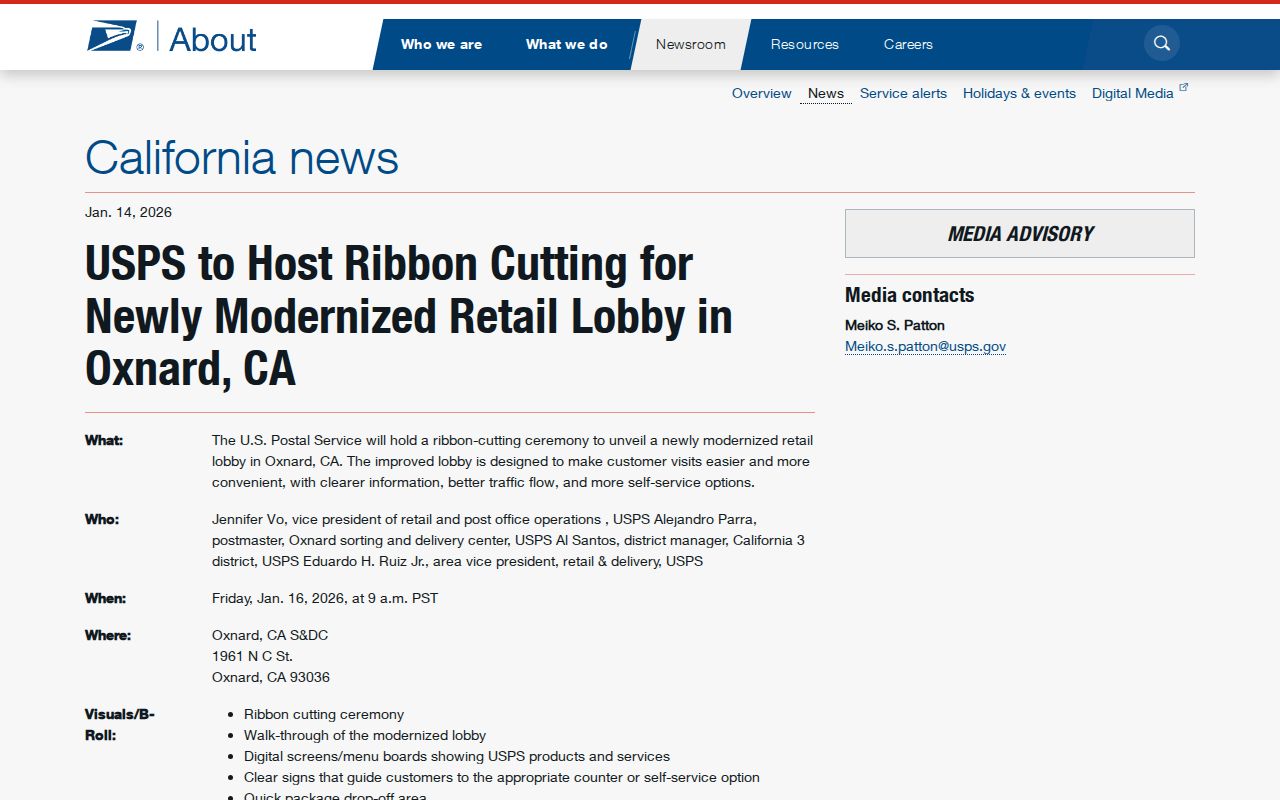
That timely facility update helps date the postal source, but it does not announce a new city line, neighborhood boundary, or resident directory.
A ZIP does not prove residence. A postal result tells where USPS routes a delivery. It does not prove that the addressee lives there, owns the parcel, or belongs to a named Oxnard neighborhood.
ZIP Code Terms for Oxnard Searches
Short definitions prevent a postal clue from carrying more weight than it can support. These terms describe delivery mechanics, not a public roll of Oxnard households.
Definition box.
- ZIP
- A five-digit USPS delivery area used to route mail. It is not a city limit, neighborhood line, or resident count.
- ZIP+4
- Four extra digits that refine delivery within a five-digit ZIP. It narrows routing, not identity or residence.
- PO-box ZIP
- A code used for post office boxes. Locally, 93031, 93032, and 93034 are mailbox codes rather than residential districts.
- Unique ZIP
- A code assigned to one organization or institution instead of a broad set of street deliveries.
- Carrier route
- An operational delivery route inside the postal system. It is not a public neighborhood or jurisdiction boundary.
No official static City or County ZIP-boundary map was located in the research. These neighborhood descriptions are orientation aids from official maps and addresses, not legal lines. For family history, an estate question, or lawful reconnecting, keep the source date, full address, ZIP result, jurisdiction, neighborhood lens, and APN separate. That uncertainty is more reliable than turning a ZIP into a claim about a person.